Flood
Low-lying roads, fords and bridges flood quickly after heavy rain, endangering drivers and cutting access; knowing the moment water breaches the bank is critical.
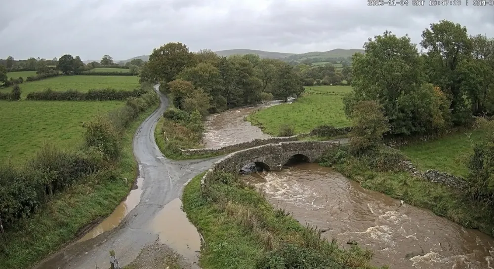
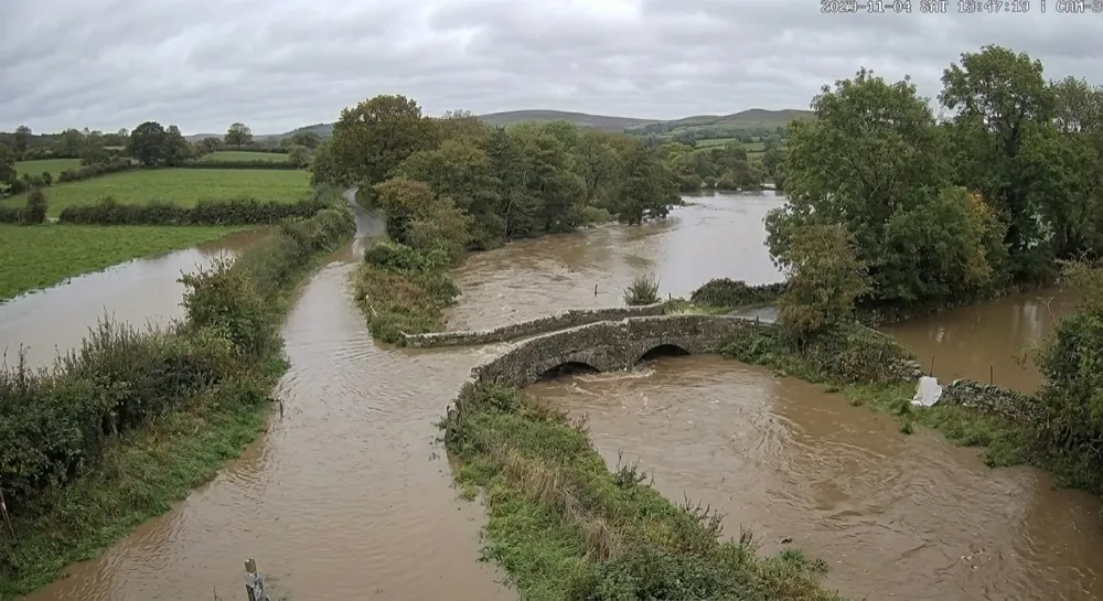
Timed capture. Generative AI reports swollen brown water near the top of the banks, the road wet but passable, level about 1.1 m. The rate-of-rise rule warns the duty engineer; no closure yet.
A timed capture. No PIR or radar involved; every frame is uploaded and read by generative AI.
A rising river makes no motion a PIR would see, so the camera captures on a timer, hourly and every 15 minutes once the level is rising, and every frame is uploaded. Generative AI reads the water against the bridge arch and the road and returns a level; the series is charted, and the alert rule fires on the level or its rate of rise.
- Wake
- Timer only; capture rate rises when the level is rising
- Schedule
- Capture every hour; every 15 minutes while the level is rising. Every frame is uploaded.
- On the camera
- None. A rising river is not motion, so nothing is filtered on the camera.
- Your criterion
Estimate the water level in metres against the bridge arch and bank markers. Is the road dry, wet or under water?
Written in plain English. The model reads every escalated frame against it.- Alert rule
level > 1.5 m OR rise > 0.3 m per hour · hold-off 60 min · re-arm when level < 1.0 m- Who is told
- SMS to the highways duty engineer; webhook to the road-closure system; email to the parish and the drainage board.
- Evidence kept
- Hourly levels kept as a time series for 12 months; frames kept for 90 days.
 Machairanow
Level 1.8 m and still rising. Water across the whole carriageway; signpost half submerged.
A readable account of what triggered it, with the frame attached. No feed to watch, no captures to trawl through.